

1. Introduction
In the social-ecological systems context, resilience is the capacity of a system to respond to and learn from stressors and to keep the system functioning (Adger, 2000; de Bruijn et al., 2017; Folke et al., 2010; Gunderson, 2000). Yet, much of the literature on resilience focuses on responses to extreme events, such as natural disasters, leaving less attention to how resilience is built and sustained through everyday practices (Hall, 2019; Ziervogel et al., 2017). In this study, we claim that understanding the emergence of resilience requires widening the focus by incorporating daily routines and customs (Henwood et al., 2008). This research thus addresses the lack of attention to daily practices by examining how these practices, shaped by environmental challenges, contribute to a long-term resilience, and how they evolve over time and are reflected in the landscape.
Landscapes play a significant role in the adaptation of practices. They represent long-term human-environment interactions (Brown & Goetcheus, 2023, p. 216), and tangible adaptation measures indicate how humans adapt their practices to disturbances in social-ecological systems. Landscapes are the environment where practices develop over time and reflect how these practices of adaptation improve within given conditions. By focusing on landscape, this research contributes to the broader resilience discourse by offering tangible evidence of how resilience is built and maintained throughout the passage of time. The analysis of landscapes, displayed as cumulative records of adaptation, bridges the gap between the contribution of daily practices and systemic requirements for being resilient.
Adaptation—a concept central to this study—is regarded as a pivotal element for enhancing resilience capacity. Adaptive capacity represents an important aspect of the resilience of a system, enabling a system to learn, adjust, and reorganize when facing disturbances (Carpenter et al., 2001). In alignment with resilience researchers, adaptation is recognized as a crucial component of resilience and plays a significant role in enhancing it (Folke et al., 2010; Oliva & Lazzeretti, 2017; Walker et al., 2004). In this research, adaptation is defined as the strategies employed by actors within the system to address disturbances. Investigating daily adaptation provides a valuable approach to understanding the dynamic process of resilience. By implementing adaptive strategies, systems enhance their capacity to respond to both recurring challenges and unpredictable events.
This research focuses on daily adaptations in the landscape, considering spatial and temporal aspects, which together provide a complementary perspective for a comprehensive understanding of these adaptations. The landscape is an appropriate setting to observe the coping measures implemented by actors. Drawing on Cutter’s (2016) reflection on “resilience for whom,” this study considers the roles of various actors within the system. We categorize them along two lines, community and government, representing different scales and means for action. This separation allows for a more practical analysis of how different actors implement diverse adaptations to cope with the northeast monsoons.
Building on this understanding of actors’ adaptations, we draw connections to disaster risk management, where benchmarks or baseline conditions are increasingly identified to assess resilience (Camacho et al., 2023; Cutter et al., 2010). Policies to prepare for and prevent or reduce negative impacts of future adverse events on communities seek tools to measure resilience baselines and to develop adaptive strategies to enhance resilience (Camacho et al., 2023). Cutter et al. (2010) developed a quantitative approach to measure baseline resilience, by creating an index weighting 36 indicators, frequently used and updated thereafter (Cutter & Derakhshan, 2018). Researchers and practitioners focusing on climate change adaptation also seek baseline assessments to identify resilience or apply vulnerability baselines (Thomalla et al., 2006). Such baseline evaluations are meant to identify shortcomings and to recommend effective adaptation strategies. Inspired by the concept of baseline resilience, we apply a qualitative approach to assess how daily adaptations contribute to coping with extreme events. In this way, we use the baseline concept from disaster risk management and climate change adaptation to focus on everyday adaptations that facilitate responses to extreme events.
The objective of this study is to focus on daily practices of monsoon adaptations to the winter north-east monsoon in the landscape of the Penghu Archipelago. By examining these daily adaptations from a socio-ecological systems perspective, the research explores how a system builds a baseline of resilience that may also support responses to extreme events with similar attributes.

The Penghu Archipelago, Taiwan
The Penghu Archipelago, Taiwan serves as a suitable case for our study. The Penghu Archipelago is exposed to two distinct types of wind-related challenges: the strong and persistent north-east winter monsoon, and the less frequent but intense summer typhoons. These environmental conditions, we hypothesize, provide an ideal setting to study how Penghu government and communities adapt to recurring wind challenges and build resilience as time progresses. Monsoons in Penghu bring strong seasonal winds that can reach speeds comparable to moderate typhoons (Penghu Government, 2024), making wind resilience an essential aspect of daily life. The landscapes and daily practices developed under the steady influence of monsoon winds offer valuable insights into how the Penghu government and residents cope with persistent environmental pressures.
The Penghu Archipelago, positioned in the Taiwan Strait approximately 50 kilometers to the west of Taiwan’s main island, encompasses around 90 islands (c.f. Figure 1). Among them, 20 islands are consistently inhabited and are home to 107,739 residents (Penghu Government, 2023). Notably, the largest islands within the Penghu group include Penghu, with the city of Makong, Xiyu, Baisha, Wangan, and Qimei. In terms of land area, the entire archipelago spans 141.1 km².
From a demographic and historical perspective, Penghu has experienced several waves of political and economic transformations following shifts in its governance. Initially, Penghu was inhabited by Taiwan’s indigenous tribes. Evidence of their presence is found in archaeological sites on the islands (Tsai, 2009; Tsang, 2006). Since 1281 Penghu has been incorporated as a military outpost into the territory of the Yuan Dynasty. After a maritime ban during the Ming dynasty, through which most of the population from Penghu was removed to Fujian, resettlement started again towards the end of the Ming dynasty. The majority of present-day residents are descendants of early Qing immigrants who arrived in the 17th century. Initially serving as a stopover station for travelers on a route to Taiwan’s main island, Penghu gradually developed into permanent settlements as people began to gather and explore the area.
Furthermore, Penghu’s history, demographics, and politics have been significantly influenced by various international interventions over the centuries. Notably, the Dutch colonizers established a fortress and trade post on Penghu from 1622 to 1624 and trader-pirates from Asia and Europe continued to meet on the islands. Some foreign influences persist, with the islands still commonly referred to as the Pescadores (Fishermen’s Islands), a name bestowed by the Portuguese in the 16th century. However, despite the Portuguese designation, fisheries have never been the primary economic activity in the region. Most families were engaged in fishing in the summer months, and when seas got rough and the sun less torching, agriculture became the center of activity. The Penghu Archipelago experienced Japanese colonial rule from 1895 to 1945. In 1949, after losing the Chinese Civil War, KMT retreated to Taiwan, bringing soldiers and their families. Penghu and other outlying islands were also integrated into the military defense strategy. The Japanese-built West-East oriented airport was replaced by a North-South oriented, larger airport, presumably avoiding crosswinds during takeoff and landing. Harbors were enlarged, almost doubled, attempting to boost the fishery sector on the islands.
“Wind Islands,” the Penghu Archipelago’s nickname, highlights the crucial role of wind in shaping both the physical characteristics of the islands, its cultural landscape, and the daily experiences of its inhabitants. On the Penghu Archipelago, the two significant wind phenomena are typhoons and monsoons (National Science & Technology Center for Disaster, 2014).The characteristics (intensity, direction, and seasonality) of typhoons and monsoons play a pivotal role in shaping the social-natural interactions on the Penghu archipelago in different seasons (Liu, 2022; Penghu Government, 2005).
Monsoons are known to Europeans as trade winds. In local terminology it is called north-eastern seasonal wind (東北季風), with shifting wind direction, twice a year after each equinox, a significant meteorological distinction. Due to the valley effect formed in the Taiwan Strait – the Asian continent to the west, the Taiwanese mountain range with 100 peaks above 3,000 meters to the east – wind speeds up when passing from north to south over Penghu. The Penghu winter monsoon brings dry cold air from Siberia and Mongolia, over the Korean peninsula, in a slightly westwardly curved line over Penghu to Vietnam and further south. These winds prevail non-stop from October to April. Because this monsoon lasts for six months, adaptations to its impacts have become daily practices for government and communities. Despite the annual average wind speed on Penghu measuring 6.3 m/s, wind speeds during the winter northeast monsoon occasionally escalate to the threshold of a moderate typhoon. The focus of this paper is on the relatively understudied monsoon implications and its consequences for wind resilience and adaptation.
Typhoons are another type of wind on Penghu. Typhoons are cyclones or tropical depressions that develop over water. They require low wind shear between the lower layers of the atmosphere and large sea surfaces with water temperatures of over 26.5°C at depths of up to 50m. High humidity serves as a source of latent heat energy and high wind speeds (Terry, 2007). When tropical cyclones form over the Northwest Pacific Ocean they are referred to as typhoons. The Central Weather Bureau of Taiwan uses the wind speed near the cyclone’s center to categorize its intensity, ranging from mild typhoon (17.2-32.6 m/s) to moderate typhoon (32.7-50.9 m/s) and strong typhoon (<51 m/s) (Central Weather Bureau, 2023; Penghu Government, 1960). According to governmental statistical data, ten severe typhoons have passed through Taiwan since 2014. Based on the historical records of typhoon routes affecting Taiwan from 1911 to 2021, only 13.5% of typhoons passed directly through Penghu (Central Weather Bureau, 2023, p. 22; Shieh et al., 1998),, with the majority of them first making landfall on the Taiwan main island. In these cases, the intensity of typhoons declined. The Penghu Islands experience severe typhoon events approximately once per century(Central Weather Bureau, 2023, p. 22; Shieh et al., 1998). While both the monsoon and typhoons influence the islands, it is important to note their difference implications and the different challenges they represent. Monsoon are more of a constant, daily pressure to the system and therefore focus of the paper. Typhoon can be more severe but are also much less frequent and unpredictable in their timing.
2. Methods
To investigate the daily practices of monsoon adaptations in the landscape, spatial and temporal aspects informed the methodological choices. The temporal aspect holds particular importance as it encompasses the core concepts of resilience, including the evolution and transformation of adaptations, and learning processes over time. Adaptations also have to be understood in the spatial context they occur in and in which they are visibly and tangibly engrained. The physical space determines the possibilities of adaptations, which are dependent on the environmental conditions, on the materials available, as well as on other landscape elements present. This research selected two mixed methods: mapping adaptations to monsoons in the landscape and tracing the trajectory of monsoon adaptation from a historical perspective through archival research. The combination of mapping and archival research provides a comprehensive view of daily adaptation, linking historical and current adaptation practices as visible in the landscape.
Mapping of adaptations to monsoons
The method of mapping documents the human-nature interactions in the landscape. The landscape can be seen as multi-layered (Stabbetorp et al., 2007). Layers reflect cultural and land use decisions made at specific times, showing how government and communities influence the utilization of land through spatial politics. In our work, mapping gives the opportunity to bring to light the local adaptations to monsoon in their materiality. Mapped objects can then be analyzed in their spatial dimension to reveal the transformation and accumulation of resilience practices in Penghu.
The mapping process consisted of recording visible objects that demonstrated intentional adaptations to monsoons. In this sense, every object mapped represents an attempt and a very concrete strategy to deal with monsoon and to prevent damage to people and properties. Two categories of mapped objects were collected: public and private. The public ones are those installed by the government and formal institutions, whereas private objects are those set up by community members for private or household use. Mapping objects were found in the public space as well as in the outside area of private households. Private household inner spaces were not included in the mapping process due to privacy and accessibility reasons.
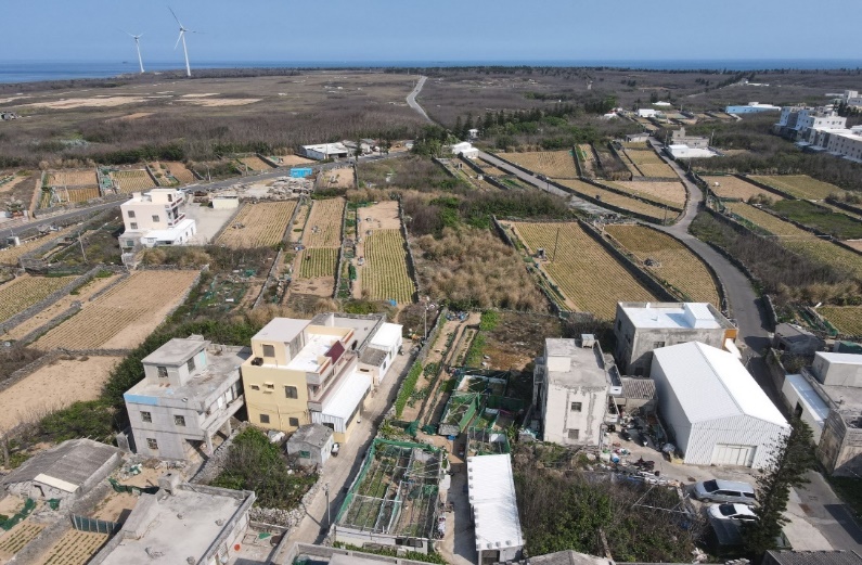
Mapping took place in seven communities on Makong main island. Choosing Makong Island as the mapping area was based on three reasons. First, Makong is the central settlement area on the Penghu Archipelago, with a rich and multi-layered history of colonization by different regimes. Second, Makong is extensively documented in archival data, allowing the existing archival research to be complemented by mapping data. Third, Makong offers diverse landscapes, including urban and rural settlements.
Several criteria guided the identification and selection of the seven communities. First, historical and geographical significance played a role, as detailed in Penghu jilüe (Zhou, 1743), the oldest historical record on Penghu, which describes immigrant settlements from the 16th century established by Han migrants. Second, wind speed and exposure zones were key factors. Communities were chosen based on their significant exposure to monsoons, as identified through expert recommendations from the Makong weather station and corroborated by relevant weather statistical data (Zhou, 1743). The following communities were chosen for the study: Shagang (沙港) and Xingren (興仁) in Makong City District and Beiliao (北寮), Lintou (林投), and Huxi (湖西) in Huxi District. In addition to the communities on the main island of Penghu, we also included two isolated islands, Tongpan (桶盤) and Hujing (虎井), with each being home to a community of the same name.
The fieldwork of mapping was conducted in these seven communities in October 2020, focusing on the central areas of the communities with the highest concentration of houses. The mapping process involved visual identification and systematically documenting objects related to monsoon adaptation as found in every alley and road of the selected communities. When an adaptation object was identified, its location was recorded with GPS data, and photographs were taken. These data were later integrated into a GIS platform for analysis.
Limitations of our method include the geographical focus of the mapping process focusing on the main island Makong City and Huxi District, mainly excluding small outlying islands. While this approach allows for an in-depth exploration of adaptation strategies in a central location, it potentially limits the generalizability of potential findings to the entire archipelago and beyond. Furthermore, intangible or cognitive adaptations at the basis of those adaptation strategies are invisible in the mapping. For example, the timing of practices related to gardening and the detail method of spatial arrangement within gardens is not or insufficiently represented in maps.
Tracing the trajectory of monsoon adaptations
Archival research refers to the location, evaluation, and systematic interpretation and analysis of the archival resource by social scientists (Lewis-Beck et al., 2003) Within our study, archival research focuses on the temporal aspect, aiming to understand adaptations to wind throughout Penghu’s history. This includes not only the identification of past strategies of coping with monsoon, but also the analysis of their transformation. Sources consulted in this research have been retrieved from the Penghu Culture Documentation Center, the Penghu Library, the National Central Library, and online databases such as the Penghu newspaper database and the Penghu Book Database. The themes targeted in the databases were monsoon events, policies, and related activities from the late 17th century.
We first identify monsoon events recorded in archival documents, including the documented damages and impacts, as well as the starting points of adaptations implemented by government and communities. Archival research serves as a complement to the mapping method, as it provides a chronological perspective that cannot be directly observed in the landscape. However, the archival research is constrained by the preservation and accessibility of documents and archives, particularly those from centuries ago.
The analysis process of mapping and archival research is interactive. Observations from mapped objects are cross-checked with archival records to determine when the adaptation was established, how it was implemented, and whether it expanded, flourished, or declined over time. As elaborated in the following section, we were able to identify a variation of patterns across different periods, mainly the Qing dynasty (1683-1895), Japanese colonial rule (1895-1945), and the period since 1945.
3. Results
In total, 489 objects were identified in the selected communities during the mapping process. The photos were taken with embedded GPS data and then imported into GIS software and categorized. According to the mapping categories, 42 objects are public and 447 objects are private. The private household adaptations to strong monsoons are ubiquitous and accumulatively delivered through generations, such as double-layer small windows, the choice of location and direction of settlements, and the techniques of roof reinforcement. The prevalence of private adaptations might have been biased by the mapping process, focusing primarily on living areas, where individual responses to wind are more frequently observable. Yet numeric counts neither reflect the scale nor the impact: in the mapping process, a public adaptation like a harbor, with its large size, investment, and influence, is counted as a single object, just the same as a single clothes hanger tied to a clothesline. Therefore, we focus on the quality of the adaptation to understand how government or community address the challenges posed by wind.
Through the archival research, 61 decisive points in the time could be dated: 11 points from the Qing Dynasty (1683–1985), 10 points from the Japanese colonial period (1895–1945), and 40 points from the period since 1945. After identifying these points, we organized them chronologically on a timeline in order to analyze the changes in monsoon adaptations over time.
Combining mapping and archival research results, we found monsoon adaptations are manifested variously in different periods according to the needs and priorities of different regimes.
Penghu under the Qing dynasty (1683-1895)
Penghu, originally serving as a stopover point for travelers on their route to Taiwan, gradually evolved into a settlement for immigrants. Consequently, communities began to form and evolve. The earliest recorded evidence of adaptation to monsoons in the landscape can be traced back to 1730, which marks the earliest record of walled gardens, so-called Caizhai (Chen, 1955). Caizhai (菜宅) literary means house for vegetable. A Caizhai is typically considered private property, associated with specific families, and often built near their houses. These walled gardens were strategically designed to mitigate the impact of the strong north-east monsoon and protect crops from damage through winds. Walls tend to have an average height between 1.7 to 2 meters, with the highest walls oriented towards the north-east. For their construction, islanders relied on locally sourced materials, such as the basalt or coral rock, see Figure 2. Most sensitive vegetables are planted close to the north-eastern wall, while fruit-trees tend to be located in the north-eastern and north-western corners of the Caizhai where they are protected from two sides. Caizhai are not only the starting points of adaptation in the records, but also the most widespread and visible adaptation to wind resilience in the landscape.
Caizhai structures are believed to exist on the Penghu Islands before the time of their first occurrence in an official record. Nowadays, the agricultural function of Caizhai is steadily decreasing, providing only a source of fresh vegetables for a family household.

Penghu under Japanese colonial rule (1895-1945)
Directly after conquering Taiwan in 1895, the Japanese administration took significant steps to enhance meteorological data recording and processing. Notably, the Makong Meteorological Observatory station, the first specialized weather observatory in Taiwan, was established in 1896. Located 10 meters above sea level and free from surrounding buildings that could interfere with observation data, this station provided accurate and reliable weather information. This is the first modern operation introduced to the Penghu Archipelago. Precise weather data can enhance the forecasting of wind speeds during monsoon seasons and typhoons.
In the Japanese colonial period, the other two most noticeable wind policies were the establishment of windbreak forests and large-scale windbreak walls. The initiation of windbreak forest projects (Taisaku, 2020) was introduced on Penghu as a ten-year plan in 1913. The aim was to mitigate the impact of strong coastal monsoon (Isaburō, 1932). The windbreak forest policy continued until today to safeguard Penghu’s coastal areas and contribute to sand stabilization on the islands. As Figure 3 Penghu Conservation Forest with four categories shows, windbreak forests are still planted and maintained nowadays along the northern coast of Penghu Island.

Another innovative but time-consuming adaptation was the construction of large-scale windbreak walls. Different from windbreak forests, windbreak walls were erected across the island instead of only along coastal areas. They cover farmland, as the initial purpose was to facilitate agriculture and protect communities from strong monsoons. These walls were constructed primarily from basalt and coral, and they have an additional layer of tall subtropical grasses (satin tail) measuring between 1.5 and 1.8 meters in height (Isaburō, 1932).
The windbreak walls construction project was initially undertaken from 1926 to 1928. Windbreak walls were strategically positioned at the northern edges of significant fields and oriented against winter monsoons. Differing from the household-scale Caizhai, these windbreak walls crisscross the island with mathematical accuracy for kilometers with a large scale from one side of an island to the other. They were standing between 1.5 and 1.8 meters and featured a width of about 0.9 meters, filled in the center with soil for the planting of satin tail. The windbreak walls were located outside of the island community. The construction started from the north part of the island and extended gradually to the south. Differing from the still maintained windbreak forest policy, windbreak walls are now abandoned. The reasons for their abandonment relate mainly to their top-down design in mathematically conceived patterns, cutting through private property, cutting off the access to water resources like wells (Yu-huang et al., 2010), and their distance to the village. In addition, these walls repeating each other at a distance of about 50m, in contrast to the 10 meters of the private Caizhai, provide questionable wind blocking effects.
Penghu after 1945
After the Second World War (WWII), the local government has consistently maintained the windbreak forests. At the same time, the government implemented new adaptations aiming at monsoon resilience. These include planting trees along wind battered roads connecting villages, and the installation of regular traffic signs and warning boards that informing people about strong wind gusts at intersections or between buildings. In addition, fostering the fishing industry after WWII, the harbors built under the Japanese government have been extended, re-enforced, or replaced by new harbors. Likewise, the size of public transportation ferries that run between the main islands of Penghu and Baisha and the outlying islands has continuously been increased, reducing the number of days they could not operate due to strong winds and high waves. Compared to the overall transformation the islands underwent in the attempt to boost tourism and its associated service industry, wind-induced transformations were limited in scope and effect.
The arrival of tens of thousands of tourists annually on the islands raised the question of how to provide them with water and energy, turning to local resources like salt water and wind. The perspective on wind thus changed from an annoyance and potential danger to a source of renewable energy, which could eventually power desalination plants, replacing the diesel-driven engines that run day and night in the vicinity of the harbors of outlying islands. In 2001, Taipower, a state-owned power company, started the installation of a wind park at Zhongtun on Baisha Island. The wind park interferes little with the community of Zhongtun, which is directed toward the south-east of the island, separated from the wind park through a hill and the main road connecting the two bridges. The Zhongtun wind power station features eight wind turbines and is the second-largest wind power station in Taiwan. It contributes approximately 12% of the total power generation for the main island of Penghu. Integrated with a scenic bicycle path and a parking lot, the wind park became a tourist site and a landmark of Penghu.
In 2011, the Ministry of Economic Affairs launched the Penghu Low Carbon Island Wind Power Project (Li et al., 2012), with Taipower designated as executive office for the initial phase of wind power development. A second wind power station was established in Longmen, at the east-coast of Penghu Island in 2014. This project, however, met opposition from the local community as they considered the harmful to the local feng shui and the community did not feel its interests and rights were sufficiently recognized and respected, which ultimately led to the failure of the project.
Another point worth mentioning is that, over time, the focus of adaptation during the three periods (1683-1895, 1895-1945, and post-1945) shifted from addressing monsoons to dealing with typhoons. We argue that this shift has been driven by economic transformations. According to Isaburo (1932), before and during the Japanese colonial period, agriculture was the main source of food. In the 1930s, for example, 70% of Penghu’s population worked in agriculture (Isaburō, 1932). Subsistence farming was common, using a family’s Caizhai for planting vegetables directly in the wall’s wind-shield, while planting peanuts, sweet potatoes, and sweet potatoes in less protected larger fields. In 2015, the number of households still active in farming dropped to 15% (Penghu Government, 2016) and tourism became the main economic pillar of Penghu (Wu & Tsai, 2014). The need in Caizhai for its high windbreak walls decreased as a consequence of this economic transformation. The supply with commodities from Taiwan to Penghu increased and stabilized even through the winter months through improved naval and aerial transportation capacities. This set free the attention of governments to focus on typhoons, which tend to hit in summer and autumn, a time tourist from Taiwan flock to the Penghu Islands.
But still, the adaptations and awareness of monsoons have been passed down through generations and are deeply rooted in daily life. During fieldwork, we observed how people adapt in different practical ways. This can be illustrated through the variation of practices of drying clothes. While some people rely on a battalion of clothespins, others use a twisted pair of clotheslines through which clothes are pulled. Still others use clothes hangers fixed with wires while others tie their clothes to the clothesline. Also, wind speed and wind direction are deciding factors of which routes people chose when riding a motorbike, avoiding higher elevations and unprotected roads, reducing the risk of being blown over or losing control. Penghu residents are highly aware of strong wind gusts at specific intersections that pose dangers. Conversations among residents often include reminders to be careful in such areas, or to avoid them altogether, reflecting the community’s ingrained awareness and resilience. Furthermore, residents are aware of their local knowledge as, despite their economic interest, scooters are not rented out to tourists during the winter monsoon. As wind directions are stable and well known, residents also communicate in terms of the cardinal directions e.g., heading north to the next convenience store.
Monsoon adaptations in Penghu, we claim, provide a baseline for resilience to typhoons, as winter monsoon winds can sometimes reach speeds comparable to, or even stronger than, certain typhoons, as claimed by local residents. Fieldwork revealed that structural adaptations such as double-layered windows, reinforced roofs, and windbreak walls—originally designed to withstand the persistent and strong winter monsoon—also serve to mitigate the impacts of moderate typhoons. These adaptations, visible in the mapped communities, demonstrate a dual purpose. This can be seen nowhere better than in the daily practices of Penghu residents, as these daily practices shaped a puzzle of resilience functions that contribute to typhoon preparedness. For instance, residents are acutely aware of wind-prone intersections that could pose dangers during all kinds of strong winds and adjust their routes. Their awareness shapes the way they park their scooters and what they do with their helmets (e.g., not hanging it on the sideview mirror as in Taiwan but carrying it home), all to avoid accidents and losses. Securing moveable objects with ropes and weights, by arranging entrances to houses, temples and public buildings at different sides of a building, having the choice among harbors in different directions of the village, sometimes called winter or summer harbor.
The cooperation between government and community is observed during an approaching typhoon. Fishermen go to harbors to check their boats carefully, ensuring they are securely docked. If a boat is damaged or an electric pole has fallen on the road, they promptly inform the owner and report it to the government. This efficient communication ensures that issues are addressed more quickly. Mutual assistance among fishermen is also common; for instance, they discuss and organize who will monitor the situation during the typhoon period, demonstrating strong community coordination and support. This localized knowledge and the cooperation between government and communities has been accumulated through generations of living with strong monsoon winds. This offers a transferable framework for responding to typhoon hazards and a mechanism of cultural transfer and learning.
Our spatial-temporal investigation of monsoon adaptations on the Penghu Archipelago resulted in three primary empirical findings. Firstly, wind resilience is deeply embedded within the daily practices of Penghu residents, including landscape as practice, as shown through our mapping. Secondly, according to our archival research, the decisive points identified, and our observations of the mapping process, monsoon adaptations in the landscape of the Penghu Archipelago are changing due to shifts in the economic structure and the government regime. Thirdly, Penghu residents effectively adapt to the challenges posed by strong monsoons through the intergenerational accumulation of knowledge.
4. Discussion
The patterns mentioned during the three periods display different attention to monsoon adaptations. In general, the private adaptations for guarding property gradually developed over time. The Japanese colonial administration imported modernity with the meteorological station in Makong and established the policy of windbreak forests and windbreak walls. These policies were ambitious and experimental. In the end, the failed windbreak walls policy formed the cultural landscape to limit the impact of strong monsoon winds. Compared to focusing only on monsoon adaptations, the government now tries to benefit from wind use. Moreover, with the increasing awareness of disaster events following international trends, the government put more effort into preventing potential disasters rather than adapting to monsoons. But monsoon adaptations have left a significant imprint on the landscape, reflecting both historical practices and evolving governmental priorities.
Monsoon adaptations form a baseline for wind resilience
In the nexus of science, policy, and practice on disaster risk management, assessing baseline resilience is a common approach (Camacho et al., 2023; Cutter et al., 2010). Our research revealed daily practices of adaptations against monsoons and to some degree these insights can be transferred to typhoon resilience. Core elements of both wind systems people have to adapt to are the intensity of wind and the wind direction. Regarding wind intensity in the case of Penghu, monsoons can reach high wind speeds, but typhoons can reach more severe levels. Nevertheless, to some extent, the monsoon adaptations suffice moderate typhoons and reduce the impacts of rare and more extreme typhoon wind intensities. Regarding wind direction, monsoon winds are relatively consistent coming from northeast directions. The monsoon adaptation infrastructure is applied to face this direction. The wind direction of typhoons changes along their rotating paths, making adaptive measures against monsoons of limited use against severe typhoons. Worth mentioning, the heavy rainfall associated with typhoons may cause flooding, however, in Penghu’s case, typhoon-induced flooding is rare due to the island’s topography, which allows floodwaters to retreat quickly.
The baseline in this study represents a localized phenomenon specific to Penghu, where monsoon and typhoon winds share similar attributes. This baseline is a privilege arising from the region’s annual exposure to monsoons, which allows actors to adapt to wind challenges through the accumulation of knowledge over generations. This overlap enables adaptations to monsoons to serve as a foundation for coping with typhoon events. The concept of baseline resilience aligns with adaptive capacity by demonstrating how a system accumulates and refines strategies over time, enhancing its ability to respond more effectively to future challenges. By focusing on Penghu’s adaptations to monsoons, this study highlights how daily practices embedded in local culture contribute to the long-term adaptive capacity of the system.
According to the results, this research confirms that adaptations to monsoons serve as a baseline for building resilience. The baseline for resilience is an accumulative process spanning generations. These cumulative processes create a foundation that strengthens the system’s ability to respond to more severe or unpredictable events with similar attributes. The adaptations to monsoon winds have become deeply ingrained in Penghu’s culture. As a result, when typhoons bring strong winds to the islands, Penghu residents are partially prepared and can reinforce existing adaptations, offering an advantage compared to regions without similar experiences.
All adaptations of monsoons can be beneficial against the typhoon winds, forming a baseline resilience. Nevertheless, although the hazards are quite similar with both being wind systems, a transfer of monsoon resilience to typhoon or wind resilience faces crucial limitations. In the absence of a recently occurred stressor, the system can be assessed as partially prepared and exhibiting a certain level of resilience to the wind stressor. But, the quality of response to severe typhoons in future remains uncertain.
Applying a climate change adaptation perspective, new and evolving climate scenarios raise new challenges that typhoons will increase their intensity while monsoon days become less strong (Xu et al., 2006). This raises concerns about potential future challenges in the event of a catastrophic typhoon occurrence. There might be aspects that adaptations to monsoons cannot cover. This suggests that the baseline, adaptations to disturbance, becomes less effective in the long term. To address the unknown and more intense situations caused by typhoons, the Penghu government is shifting its focus from monsoon-oriented measures to typhoon disaster prevention, such as the establishment of a Disaster Prevention and Protection Office when typhoons approach. The climate scenario serves as a warning to Penghu residents that typhoons will be a future issue and should be considered more seriously.
Facing unknown situations
Starting with this baseline, our research suggests that when actors encounter disturbances exceeding the capacity of existing adaptations, resilience can be enhanced through strengthened cooperation and timely reinforcement of strategies. Reinforcing the adaptations to disturbances and fostering cooperation among actors will provide the flexibility to bridge the gap, thereby reducing the rate of unknown failures and maintaining system functionality.
On the one hand, actors can strengthen the adaptations in the landscape according to their respective interests and contributions. Reinforcing adaptations, particularly those aimed at protecting properties in the landscape, can be relatively easier by building upon the already existing foundational adaptations. On the other hand, unimpeded communication and clarity regarding respective responsibilities among actors can expedite the resolution of unpredictable impacts caused by extreme events.
Taking the example of an approaching typhoon in the Penghu Archipelago, various creative and manifested adaptations to monsoons are applied on the islands. With the fundamental adaptations to disturbance as a baseline, actors can reinforce these adaptations to address severe typhoons. For individuals, Penghu residents can secure their properties more tightly than usual or harvest crops from Caizhai earlier with the help of community members. For the government, officials can monitor infrastructures related to monsoons, such as windbreak forest areas, during typhoons and ensure that Penghu residents receive timely and updated typhoon information.
Future climate scenarios, particularly the weakening of monsoons and the intensification of typhoons, necessitate a re-evaluation of Penghu’s resilience strategies. For instance, while extended fishing seasons due to reduced monsoon strength may boost short-term economic gains, they also risk overfishing and ecosystem degradation, calling for stricter fishing regulations and the promotion of sustainable practices. Additionally, stronger typhoons pose a significant threat to existing wind adaptation infrastructure, highlighting the need for reinforced construction standards and upgraded public infrastructure, such as flood-resistant housing and storm surge prevention. Furthermore, integrating local and cultural knowledge with modern disaster preparedness initiatives can strengthen community-level resilience. By fostering collaboration and embedding climate projections into policy and planning, Penghu can proactively address the challenges posed by future climate variability.
Concluding remarks
This paper commences with the observation, that current resilience literature tends to focus on extreme events rather than everyday practices. Through the case study of Penghu, we have verified that practices that sustain resilience to winter monsoon winds provide communities with a foundation of resilience, which allows them to live under these harsh conditions. This baseline resilience is developed over time and through many daily practices. When a stressor with similar attributes occurs, the communities can draw upon their accumulated experiences and transfer, evolve, or modify their practices to deal with the stressor. In other words, resilience is and will be rooted in the daily practices which will be the means to shape future resilience.
The results of mapping and archival research demonstrate that Penghu residents coexist with and effectively cope with monsoons. Practices that sustain their resilience are deeply ingrained in Penghu culture and are passed down intergenerationally. These practices form the background to their daily activities as people are immersed in strong winter monsoon for six continuous months a year. Practices adapted to monsoons also accumulate in the landscape, they are mediated by it, and shape future practices of following generations.
Reflecting on the research design and methods we employed: Mapping and archival research have been instrumental in understanding spatial and temporal aspects of the formation of resilience. By focusing on monsoon-adapted practices, our research found the baseline of how resilience emerges from the daily practices. Additionally, this research suggests reinforcing adaptations as creative strategy and cooperation among actors, with a special focus on coping strategies for the severe typhoons that will hit Penghu more intensively than in the past when considering future challenges based on climate scenarios.
As an outlook, the climate scenarios for Penghu predict a decrease in monsoon intensity. This may have other impacts, such as an increase in the number of fishing days, potentially leading to overfishing. Also, the period that tourists will stay on Penghu might gradually extend, on the one hand contributing to the economic growth, on the other, straining the environmental carrying capacity of the ecosystem. These foreseeable problems need to be addressed in future research.
Acknowledgments
This research is funded by the Deutsche Forschungsgemeinschaft (DFG, German Research Foundation) – Project number: 421843181. I would like to thank the reviewers for their valuable feedback, the depositar at Academia Sinica, the Research Center for Asia-Pacific Languages and Cultures at National University of Kaohsiung, and everyone who supported this research on the Penghu Islands.